Precision agriculture is revolutionizing farming practices, and drone technology stands at the forefront of this transformation. As global food demand rises and environmental concerns grow, farmers are turning to innovative solutions to optimize crop yields while minimizing resource usage. Drones equipped with advanced sensors and imaging capabilities offer unprecedented insights into crop health, soil conditions, and overall farm management. This technology enables farmers to make data-driven decisions, leading to increased productivity and sustainability in agricultural operations.
Drone technology for precision agriculture
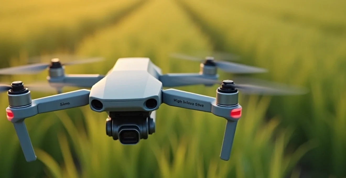
Agricultural drones have become indispensable tools for modern farmers seeking to enhance their crop mapping and management strategies. These unmanned aerial vehicles (UAVs) provide a bird’s-eye view of fields, allowing for detailed analysis of crop conditions that would be impossible to achieve through traditional ground-based methods. The ability to quickly survey large areas with high-resolution imagery has made drones an essential component of precision agriculture practices.
One of the primary advantages of using drones in agriculture is their versatility. From small family farms to large commercial operations, drones can be adapted to suit various farm sizes and crop types. They offer a cost-effective alternative to satellite imagery, providing more frequent and higher-resolution data at a fraction of the cost. This accessibility has democratized precision agriculture, making advanced crop mapping techniques available to a broader range of farmers.
The integration of drone technology into farming practices has led to significant improvements in resource management. By identifying areas of stress or underperformance in crops, farmers can apply targeted interventions, reducing waste and optimizing the use of water, fertilizers, and pesticides. This precision not only improves crop yields but also contributes to more sustainable farming practices, aligning with global efforts to reduce the environmental impact of agriculture.
Advanced sensors in agricultural drones
The true power of agricultural drones lies in their advanced sensor capabilities. These sensors go far beyond simple visual imaging, providing farmers with a wealth of data about their crops and land. By leveraging multiple types of sensors, drones can create a comprehensive picture of field conditions, enabling highly accurate crop mapping and analysis.
Multispectral imaging for crop health assessment
Multispectral imaging is a cornerstone of drone-based crop health assessment. These sensors capture data across multiple bands of the electromagnetic spectrum, including visible light and near-infrared (NIR) wavelengths. By analyzing the reflectance patterns of crops in different spectral bands, farmers can gain valuable insights into plant vigor, chlorophyll content, and overall health.
The most common application of multispectral imaging in agriculture is the calculation of vegetation indices, such as the Normalized Difference Vegetation Index (NDVI). NDVI provides a quantitative measure of plant health by comparing the reflectance of red and near-infrared light. Healthy plants absorb more red light and reflect more NIR light, resulting in higher NDVI values. This information allows farmers to quickly identify areas of crop stress or disease, enabling timely interventions to prevent yield losses.
LiDAR systems for 3D terrain mapping
Light Detection and Ranging (LiDAR) technology has revolutionized terrain mapping in agriculture. LiDAR sensors emit laser pulses and measure the time it takes for the light to reflect back, creating highly accurate 3D models of the land surface. This technology is particularly valuable for precision agriculture, as it provides detailed information about field topography, slope, and drainage patterns.
The high-resolution elevation data obtained through LiDAR mapping enables farmers to optimize field layouts, improve water management, and plan more efficient planting patterns. By understanding the subtle variations in terrain across their fields, farmers can make informed decisions about irrigation systems, erosion control measures, and even the selection of crop varieties best suited to specific microclimates within their land.
Thermal cameras for water stress detection
Water management is a critical aspect of modern agriculture, particularly in regions facing water scarcity or drought conditions. Thermal cameras mounted on drones offer a powerful tool for detecting water stress in crops before visible symptoms appear. These sensors measure the surface temperature of plants, which can indicate their hydration status and overall health.
By analyzing thermal imagery, farmers can identify areas of a field where crops are experiencing water stress, even if the plants appear healthy to the naked eye. This early detection allows for targeted irrigation interventions, optimizing water use and preventing yield losses due to drought stress. Thermal imaging is particularly valuable for high-value crops or in regions where water resources are limited, enabling farmers to maximize water efficiency and crop productivity.
Hyperspectral sensors for soil composition analysis
Hyperspectral sensors represent the cutting edge of agricultural drone technology, offering unprecedented insights into soil composition and crop characteristics. These sensors capture data across hundreds of narrow spectral bands, providing a detailed spectral signature of the land and vegetation. This rich dataset allows for highly accurate analysis of soil properties, including organic matter content, nutrient levels, and even the presence of specific minerals.
The ability to map soil composition across an entire field with high spatial resolution has significant implications for precision agriculture. Farmers can use this information to create detailed soil management plans, optimizing fertilizer application rates and types based on the specific needs of different areas within their fields. This level of precision not only improves crop yields but also reduces the environmental impact of agriculture by minimizing excess nutrient runoff.
Data processing and analysis for crop mapping
The vast amount of data collected by agricultural drones requires sophisticated processing and analysis techniques to transform raw sensor readings into actionable insights. Advanced software platforms and algorithms play a crucial role in interpreting drone-captured data, enabling farmers to make informed decisions about crop management and resource allocation.
Machine learning algorithms in drone image processing
Machine learning algorithms have become indispensable tools for processing and analyzing drone imagery in agriculture. These algorithms can automatically identify and classify different crop types, detect signs of pest infestations or diseases, and even estimate crop yields based on multispectral data. By leveraging the power of artificial intelligence, farmers can quickly process large volumes of drone imagery, extracting valuable insights without the need for time-consuming manual analysis.
One of the key advantages of machine learning in crop mapping is its ability to improve over time. As these algorithms are exposed to more data from different farms and growing conditions, they become increasingly accurate in their predictions and classifications. This continuous learning process enables more precise crop mapping and management recommendations, tailored to the specific characteristics of each farm.
Geographic information systems (GIS) integration
The integration of drone-captured data with Geographic Information Systems (GIS) is essential for creating comprehensive and actionable crop maps. GIS platforms allow farmers to overlay multiple layers of information, including drone imagery, soil data, weather patterns, and historical yield data. This integrated approach provides a holistic view of farm conditions, enabling more informed decision-making.
By combining drone-captured imagery with other geospatial data sources, farmers can create highly detailed prescription maps for variable rate applications of inputs such as fertilizers or pesticides. These maps guide precision agriculture equipment, ensuring that resources are applied exactly where they are needed, in the optimal quantities. The result is improved resource efficiency, reduced environmental impact, and ultimately, higher crop yields.
Cloud-based platforms for real-time data analysis
The advent of cloud computing has significantly enhanced the capabilities of drone-based crop mapping systems. Cloud platforms enable real-time processing and analysis of drone data, allowing farmers to access up-to-date information about their fields from anywhere with an internet connection. This immediacy is crucial for making timely decisions in response to changing crop conditions or emerging threats.
Cloud-based solutions also facilitate collaboration and data sharing among farmers, agronomists, and other agricultural professionals. By centralizing data storage and analysis, these platforms create opportunities for benchmarking and collective learning, driving continuous improvement in farming practices across the industry.
Artificial intelligence in crop yield prediction
Artificial intelligence (AI) is playing an increasingly important role in crop yield prediction, leveraging data from drones and other sources to provide accurate forecasts. AI algorithms can analyze multispectral imagery, historical yield data, weather patterns, and other relevant factors to predict crop yields with remarkable accuracy. These predictions help farmers make informed decisions about harvest timing, storage requirements, and market strategies.
The ability to accurately forecast yields has significant implications for farm management and the broader agricultural supply chain. By providing early insights into expected production levels, AI-driven yield predictions enable better planning and resource allocation, from individual farms to national food security strategies.
Regulatory framework for agricultural drone operations
As the use of drones in agriculture continues to grow, navigating the regulatory landscape has become an important consideration for farmers and drone operators. Regulations governing the use of unmanned aerial vehicles vary by country and region, with many jurisdictions implementing specific rules for agricultural applications. These regulations typically address issues such as drone registration, pilot certification, flight restrictions, and data privacy considerations.
In the United States, the Federal Aviation Administration (FAA) has established guidelines for commercial drone operations, including those in agriculture. Operators must obtain a Remote Pilot Certificate and register their drones with the FAA. Similar requirements exist in other countries, with some nations implementing agriculture-specific drone regulations to facilitate adoption while ensuring safety and privacy.
Farmers considering investing in drone technology for crop mapping should familiarize themselves with local regulations and stay informed about evolving legal frameworks. Compliance with these regulations is essential not only for legal operation but also for maintaining public trust and supporting the sustainable growth of agricultural drone applications.
ROI analysis of drone-based crop mapping
Investing in drone technology for crop mapping represents a significant decision for many farmers, requiring careful consideration of the potential return on investment (ROI). While the initial costs of purchasing drones, sensors, and associated software can be substantial, the long-term benefits often outweigh these upfront expenses.
The ROI of drone-based crop mapping can be measured in several ways:
- Increased crop yields through more precise management practices
- Reduced input costs by optimizing the application of fertilizers, pesticides, and water
- Early detection and mitigation of crop health issues, minimizing potential losses
- Time and labor savings compared to traditional field scouting methods
- Improved decision-making based on comprehensive, up-to-date field data
Many farmers report significant ROI within the first year of implementing drone technology, with benefits compounding over time as they refine their precision agriculture practices. The exact ROI will vary depending on factors such as farm size, crop types, and local agricultural conditions. However, as drone technology becomes more accessible and affordable, the potential for positive returns continues to grow for farms of all sizes.
Successful drone implementation in precision farming
Real-world examples of successful drone implementation in agriculture provide valuable insights into the potential of this technology. These case studies demonstrate how farmers across different regions and crop types have leveraged drone-based crop mapping to improve their operations and achieve tangible results.
John Deere’s integration of drone technology
John Deere, a leading manufacturer of agricultural equipment, has embraced drone technology as part of its precision agriculture solutions. The company has partnered with drone manufacturers and software developers to create integrated systems that seamlessly connect drone-captured data with John Deere’s farm management platforms. This integration allows farmers to easily incorporate drone mapping into their existing workflows, enhancing the efficiency of their operations.
One notable example is John Deere’s collaboration with Volocopter to develop the VoloDrone, a large-capacity agricultural drone capable of carrying payloads up to 200 kilograms. This innovative drone is designed for precision spraying applications, combining the benefits of drone technology with the capacity to cover larger areas efficiently. The VoloDrone exemplifies the potential for drones to revolutionize multiple aspects of farming operations beyond just mapping and data collection.
Trimble’s UX5 aerial imaging solution for vineyards
Trimble’s UX5 aerial imaging solution has been successfully implemented in vineyard management, demonstrating the versatility of drone technology across different agricultural sectors. In one case study, a California vineyard used the UX5 system to create high-resolution orthomosaic maps and digital surface models of their property. This detailed mapping enabled precise analysis of vine health, soil variations, and drainage patterns.
The vineyard managers used this information to optimize irrigation systems, identify areas of vine stress, and plan targeted interventions. The result was a more efficient use of water resources, improved grape quality, and ultimately, higher-value wine production. This case study highlights how drone technology can deliver significant benefits even in specialty crop applications where precision and quality are paramount.
DJI agras drones in asian rice paddies
In Asia, where rice is a staple crop for billions of people, DJI’s Agras series of agricultural drones has made significant inroads. These drones are specifically designed for spraying and seeding applications, offering a more precise and efficient alternative to traditional methods. In countries like China and Japan, where labor shortages and an aging farming population pose challenges, the adoption of agricultural drones has been particularly rapid.
One notable example is the use of DJI Agras drones for pesticide application in rice paddies. These drones can cover large areas quickly and apply pesticides with high precision, reducing chemical usage by up to 30% compared to traditional methods. The ability to spray in hard-to-reach areas and adjust application rates based on crop needs has led to improved pest control outcomes and reduced environmental impact. This case study demonstrates how drone technology can address specific regional challenges while contributing to more sustainable farming practices.
Agricultural drones have transformed from niche technology to essential tools for modern farming, offering unprecedented insights and efficiency gains across diverse agricultural operations.
As these case studies illustrate, the adoption of drone technology for crop mapping and management is yielding tangible benefits across various agricultural sectors. From large-scale commodity crops to specialty vineyards, drones are proving their value in enhancing productivity, sustainability, and profitability. As technology continues to advance and become more accessible, the potential for drones to drive innovation in agriculture only grows, promising a future where precision farming becomes the norm rather than the exception.